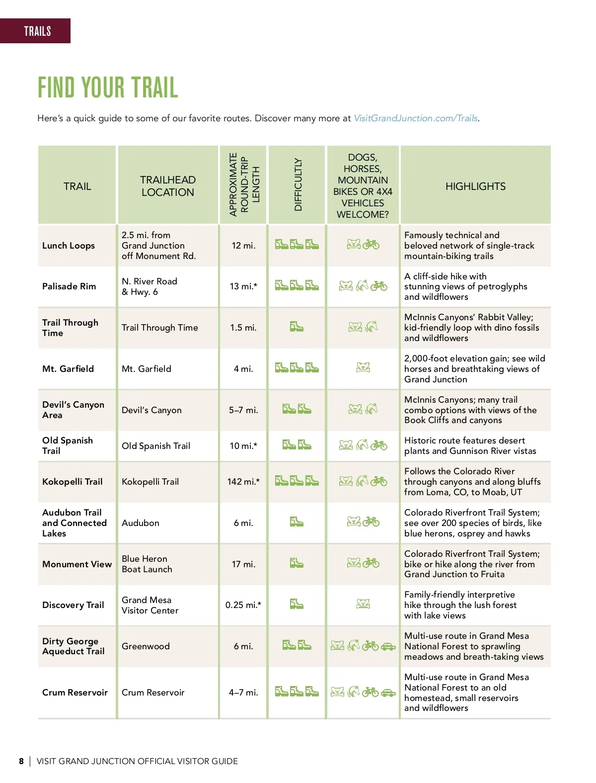
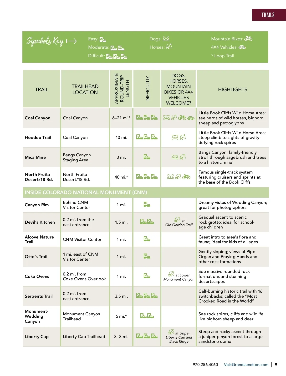
TRAILS Symbols Key Easy: Moderate: Difficult: Dogs: Horses: Mountain Bikes: 4X4 Vehicles: * Loop Trail TRAIL TRAILHEAD LOCATION DOGS, HORSES, MOUNTAIN BIKES OR 4X4 VEHICLES WELCOME? APPROXIMATE ROUND-TRIP LENGTH DIFFICULTLY HIGHLIGHTS Coal Canyon Coal Canyon 6 –21 mi.* Little Book Cliffs Wild Horse Area; see herds of wild horses, bighorn sheep and petroglyphs Little Book Cliffs Wild Horse Area; steep climb to sights of gravity-defying rock spires Bangs Canyon; family-friendly stroll through sagebrush and trees to a historic mine Famous single-track system featuring cruisers and sprints at the base of the Book Cliffs Hoodoo Trail Coal Canyon Bangs Canyon Staging Area North Fruita Desert/18 Rd. 10 mi. Mica Mine 3 mi. North Fruita Desert/18 Rd. 40 mi.* INSIDE COLORADO NATIONAL MONUMENT (CNM) Canyon Rim Behind CNM Visitor Center 0.2 mi. from the east entrance CNM Visitor Center 1 mi. east of CNM Visitor Center 0.2 mi. from Coke Ovens Overlook 0.2 mi. from east entrance Monument Canyon Trailhead 1 mi. 1.5 mi. 1 mi. 1 mi. Dreamy vistas of Wedding Canyon; great for photographers at Old Gordon Trail Devil’s Kitchen Alcove Nature Trail Otto’s Trail Gradual ascent to scenic rock grotto; ideal for school-age children Great intro to area’s flora and fauna; ideal for kids of all ages Gently sloping; views of Pipe Organ and Praying Hands and other rock formations Coke Ovens 1 mi. at Lower Monument Canyon See massive rounded rock formations and stunning desertscapes Calf-burning historic trail with 16 switchbacks; called the “Most Crooked Road in the World” See rock spires, cliffs and wildlife like bighorn sheep and deer Serpents Trail Monument-Wedding Canyon Liberty Cap 3.5 mi. 5 mi.* Liberty Cap Trailhead 3–8 mi. at Upper Liberty Cap and Black Ridge Steep and rocky ascent through a juniper-pinyon forest to a large sandstone dome 970.256.4060 | VisitGrandJunction.com | 9
Grand Junction Official Visitor Guide Grand Junction Adventure Guide: Page 9