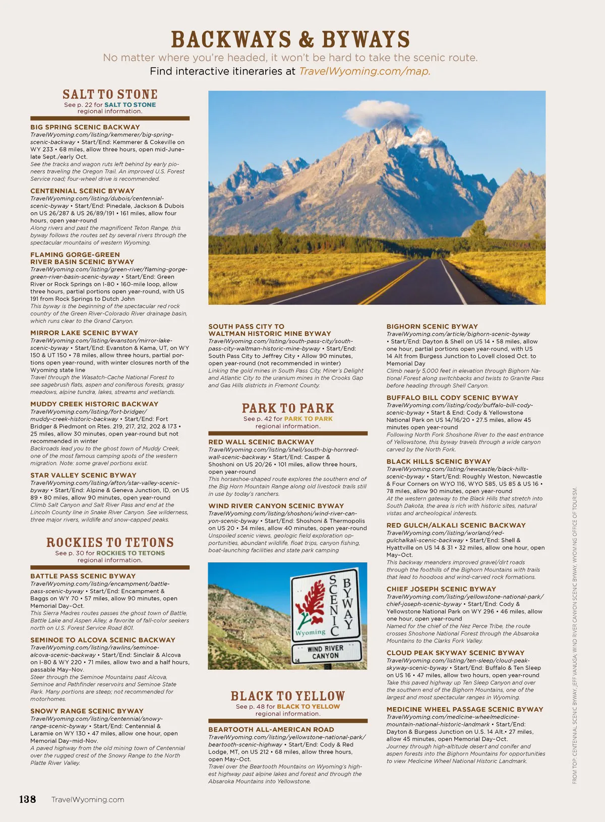
No matter where you’re headed, it won’t be hard to take the scenic route. Find interactive itineraries at TravelWyoming.com/map. backways & byways SALT TO STONE See p. 22 for SALT TO STONE regional information. BIG SPRING SCENIC BACKWAY TravelWyoming.com/listing/kemmerer/big-spring-scenic-backway • Start/End: Kemmerer & Cokeville on WY 233 • 68 miles, allow three hours, open mid-June– late Sept./early Oct. See the tracks and wagon ruts left behind by early pio-neers traveling the Oregon Trail. An improved U.S. Forest Service road; four-wheel drive is recommended. CENTENNIAL SCENIC BYWAY TravelWyoming.com/listing/dubois/centennial-scenic-byway • Start/End: Pinedale, Jackson & Dubois on US 26/287 & US 26/89/191 • 161 miles, allow four hours, open year-round Along rivers and past the magnificent Teton Range, this byway follows the routes set by several rivers through the spectacular mountains of western Wyoming. FLAMING GORGE-GREEN RIVER BASIN SCENIC BYWAY TravelWyoming.com/listing/green-river/flaming-gorge-green-river-basin-scenic-byway • Start/End: Green River or Rock Springs on I-80 • 160-mile loop, allow three hours, partial portions open year-round, with US 191 from Rock Springs to Dutch John This byway is the beginning of the spectacular red rock country of the Green River-Colorado River drainage basin, which runs clear to the Grand Canyon. MIRROR LAKE SCENIC BYWAY TravelWyoming.com/listing/evanston/mirror-lake-scenic-byway • Start/End: Evanston & Kama, UT, on WY 150 & UT 150 • 78 miles, allow three hours, partial por-tions open year-round, with winter closures north of the Wyoming state line Travel through the Wasatch-Cache National Forest to see sagebrush flats, aspen and coniferous forests, grassy meadows, alpine tundra, lakes, streams and wetlands. SOUTH PASS CITY TO WALTMAN HISTORIC MINE BYWAY TravelWyoming.com/listing/south-pass-city/south-pass-city-waltman-historic-mine-byway • Start/End: South Pass City to Jeffrey City • Allow 90 minutes, open year-round (not recommended in winter) Linking the gold mines in South Pass City, Miner’s Delight and Atlantic City to the uranium mines in the Crooks Gap and Gas Hills districts in Fremont County. BIGHORN SCENIC BYWAY TravelWyoming.com/article/bighorn-scenic-byway • Start/End: Dayton & Shell on US 14 • 58 miles, allow one hour, partial portions open year-round, with US 14 Alt from Burgess Junction to Lovell closed Oct. to Memorial Day Climb nearly 5,000 feet in elevation through Bighorn Na-tional Forest along switchbacks and twists to Granite Pass before heading through Shell Canyon. MUDDY CREEK HISTORIC BACKWAY TravelWyoming.com/listing/fort-bridger/ muddy-creek-historic-backway • Start/End: Fort Bridger & Piedmont on Rtes. 219, 217, 212, 202 & 173 • 25 miles, allow 30 minutes, open year-round but not recommended in winter Backroads lead you to the ghost town of Muddy Creek, one of the most famous camping spots of the western migration. Note: some gravel portions exist. PARK TO PARK See p. 42 for PARK TO PARK regional information. BUFFALO BILL CODY SCENIC BYWAY TravelWyoming.com/listing/cody/buffalo-bill-cody-scenic-byway • Start & End: Cody & Yellowstone National Park on US 14/16/20 • 27.5 miles, allow 45 minutes open year-round Following North Fork Shoshone River to the east entrance of Yellowstone, this byway travels through a wide canyon carved by the North Fork. RED WALL SCENIC BACKWAY TravelWyoming.com/listing/shell/south-big-hornred-wall-scenic-backway • Start/End: Casper & Shoshoni on US 20/26 • 101 miles, allow three hours, open year-round This horseshoe-shaped route explores the southern end of the Big Horn Mountain Range along old livestock trails still in use by today’s ranchers. BLACK HILLS SCENIC BYWAY TravelWyoming.com/listing/newcastle/black-hills-scenic-byway • Start/End: Roughly Weston, Newcastle & Four Corners on WYO 116, WYO 585, US 85 & US 16 • 78 miles, allow 90 minutes, open year-round At the western gateway to the Black Hills that stretch into South Dakota, the area is rich with historic sites, natural vistas and archeological interests. STAR VALLEY SCENIC BYWAY TravelWyoming.com/listing/afton/star-valley-scenic-byway • Start/End: Alpine & Geneva Junction, ID, on US 89 • 80 miles, allow 90 minutes, open year-round Climb Salt Canyon and Salt River Pass and end at the Lincoln County line in Snake River Canyon. See wilderness, three major rivers, wildlife and snow-capped peaks. WIND RIVER CANYON SCENIC BYWAY TravelWyoming.com/listing/shoshoni/wind-river-can-yon-scenic-byway • Start/End: Shoshoni & Thermopolis on US 20 • 34 miles, allow 40 minutes, open year-round Unspoiled scenic views, geologic field exploration op-portunities, abundant wildlife, float trips, canyon fishing, boat-launching facilities and state park camping RED GULCH/ALKALI SCENIC BACKWAY TravelWyoming.com/listing/worland/red-gulchalkali-scenic-backway • Start/End: Shell & Hyattville on US 14 & 31 • 32 miles, allow one hour, open May–Oct. This backway meanders improved gravel/dirt roads through the foothills of the Bighorn Mountains with trails that lead to hoodoos and wind-carved rock formations. ROCKIES TO TETONS See p. 30 for ROCKIES TO TETONS regional information. BATTLE PASS SCENIC BYWAY TravelWyoming.com/listing/encampment/battle-pass-scenic-byway • Start/End: Encampment & Baggs on WY 70 • 57 miles, allow 90 minutes, open Memorial Day–Oct. This Sierra Madres routes passes the ghost town of Battle, Battle Lake and Aspen Alley, a favorite of fall-color seekers north on U.S. Forest Service Road 801. CHIEF JOSEPH SCENIC BYWAY TravelWyoming.com/listing/yellowstone-national-park/ chief-joseph-scenic-byway • Start/End: Cody & Yellowstone National Park on WY 296 • 46 miles, allow one hour, open year-round Named for the chief of the Nez Perce Tribe, the route crosses Shoshone National Forest through the Absaroka Mountains to the Clarks Fork Valley. SEMINOE TO ALCOVA SCENIC BACKWAY TravelWyoming.com/listing/rawlins/seminoe-alcova-scenic-backway • Start/End: Sinclair & Alcova on I-80 & WY 220 • 71 miles, allow two and a half hours, passable May–Nov. Steer through the Seminoe Mountains past Alcova, Seminoe and Pathfinder reservoirs and Seminoe State Park. Many portions are steep; not recommended for motorhomes. CLOUD PEAK SKYWAY SCENIC BYWAY TravelWyoming.com/listing/ten-sleep/cloud-peak-skyway-scenic-byway • Start/End: Buffalo & Ten Sleep on US 16 • 47 miles, allow two hours, open year-round Take this paved highway up Ten Sleep Canyon and over the southern end of the Bighorn Mountains, one of the largest and most spectacular ranges in Wyoming. BLACK TO YELLOW See p. 48 for BLACK TO YELLOW regional information. SNOWY RANGE SCENIC BYWAY TravelWyoming.com/listing/centennial/snowy-range-scenic-byway • Start/End: Centennial & Laramie on WY 130 • 47 miles, allow one hour, open Memorial Day–mid-Nov. A paved highway from the old mining town of Centennial over the rugged crest of the Snowy Range to the North Platte River Valley. MEDICINE WHEEL PASSAGE SCENIC BYWAY TravelWyoming.com/medicine-wheelmedicine-mountain-national-historic-landmark • Start/End: Dayton & Burgess Junction on U.S. 14 Alt.• 27 miles, allow 45 minutes, open Memorial Day–Oct. Journey through high-altitude desert and conifer and aspen forests into the Bighorn Mountains for opportunities to view Medicine Wheel National Historic Landmark. BEARTOOTH ALL-AMERICAN ROAD TravelWyoming.com/listing/yellowstone-national-park/ beartooth-scenic-highway • Start/End: Cody & Red Lodge, MT, on US 212 • 68 miles, allow three hours, open May–Oct. Travel over the Beartooth Mountains on Wyoming’s high-est highway past alpine lakes and forest and through the Absaroka Mountains into Yellowstone. 138 TravelWyoming.com FROM TOP: CENTENNIAL SCENIC BYWAY, JEFF VANUGA; WIND RIVER CANYON SCENIC BYWAY, WYOMING OFFICE OF TOURISM.
Wyoming Official Travel Guide 2018 Wyoming OTJ: Page 138