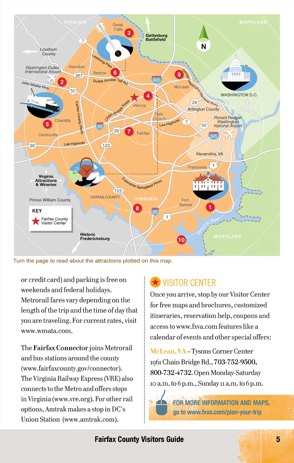
CONNECT WITH FAIRFAX COUNTY Getting Here & Getting Around With access to three airports, major highways and Metrorail, visitors have plenty of ways to get to and around Fairfax County. BY AIR The two primary airports are Ronald Reagan Washington National Airport (DCA), just east of Fairfax County, and Washington Dulles International Airport (IAD), 12 miles from Tysons Corner and 26 miles from DC (www.mwaa.com). Baltimore/Washington Thurgood Marshall International Airport ( BWI ) is located 54 miles from Fairfax County (www.bwiairport.com). Car rental, limo service, cab service, and UBER/Lyft are also available at the airports and around town. Key highways include : I-95: A major north/south route I-295, I-395, I-495: Major highways connecting Northern Virginia, DC and Maryland I-66: Serves only Virginia routes into DC, via Fairfax County, including Dulles Toll Road. High Occupancy Vehicle (HOV) inside the Beltway only during rush hour. George Washington Memorial Parkway: A national scenic highway – and National Park – situated along the Potomac River bordering Northern Virginia, DC and Maryland. PUBLIC TRANSPORTATION/TRAIN The Metro is made up of the Metrorail and Metrobus . The Metrorail has 10 stops in Fairfax County via the Blue, Orange and Silver lines. Metro includes stops in Falls Church, Merrifield, Vienna, Springfield, Huntington, Tysons Corner and Reston. Most Metrorail stations have pay park-and-ride lots (payments after hours must be made with SmarTrip card BY CAR The area’s interstates and parkways are easy to navigate, but it’s best to avoid them during rush hour (usually weekdays from 6:30 to 9:30 a.m. and 4 to 6:30 p.m.). 4 www.fxva.com
Fairfax County Official Visitors Guide 2017: Page 4